Parking Lot (Zerva Napoleonta Square)

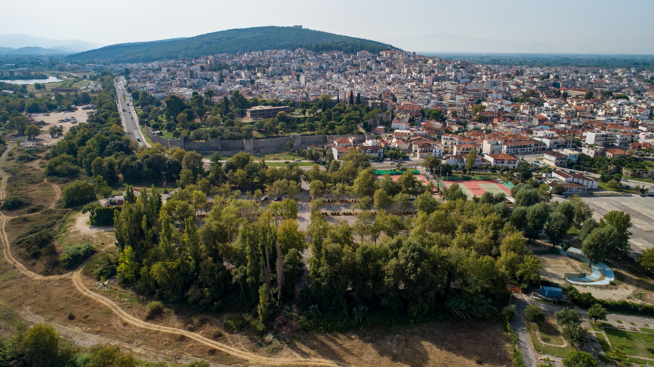
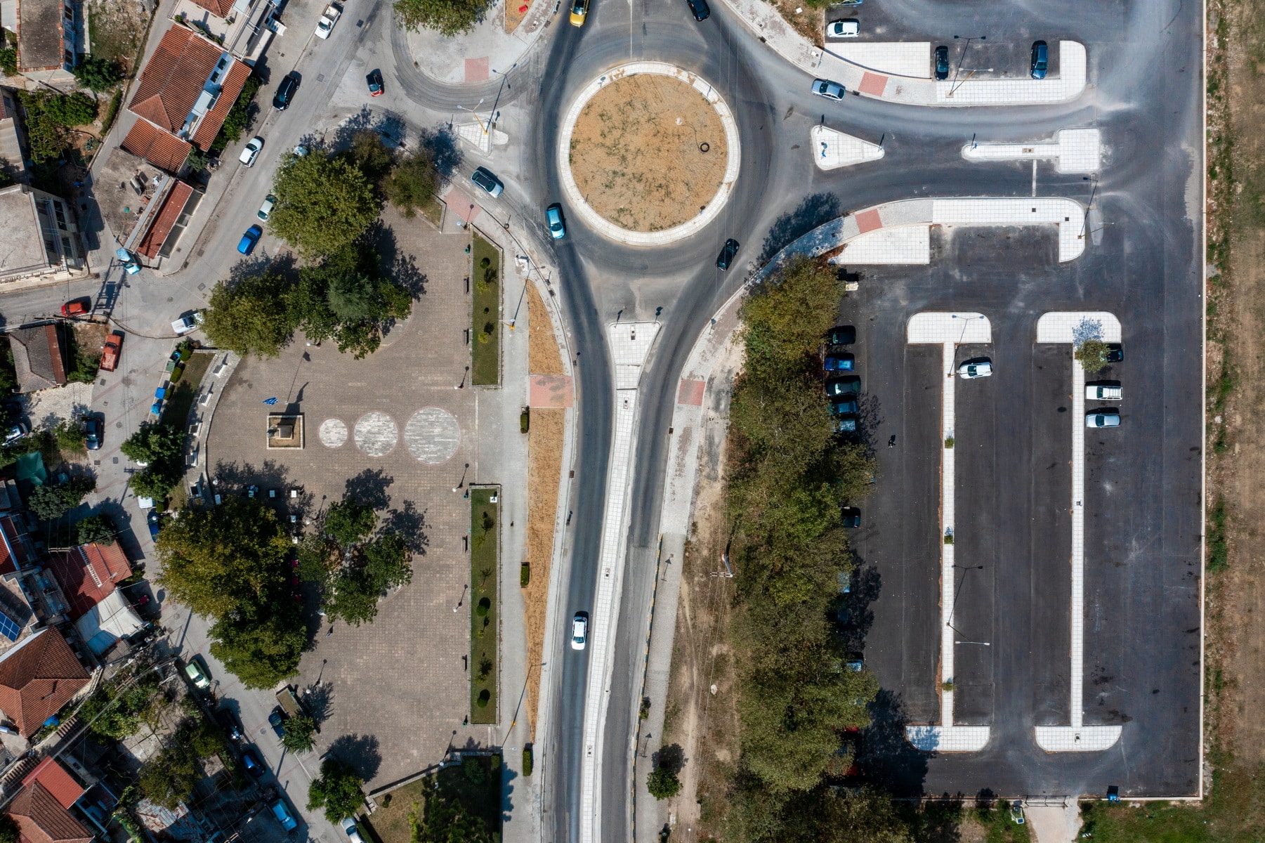
Napoleon Zerva Square lies on the Arta peripheral road, opposite the Paralimnio (Lakeside) Park and the Municipal Parking Lot occupying the triangular space formed by the peripheral road and the Krystalli Street’s curved part. The paved square has small sections of greenery and trees.
It was named after the military officer and politician Napoleon Zervas, leader of E.D.E.S. His statue stands on a high marble base along with votive columns placed behind it, around the western edge of the space, towards Krystalli Street.
It is a life-size bronze statue. Zervas seems to be taking a step forward, with his right hand bent to the side and his left hand leaning straight with the index finger pointing towards the mountains Tzoumerka, where most of the battles took place. The General looks, and his body moves in the same direction.
On the front side of the pedestal, there is a capital letter inscription:
ZERVAS NAPOLEON
GENERAL 1891-1957
GENERAL LEADER OF NATIONAL RESISTANCE
Ε.Δ.Ε.Σ Ε.Ο.Ε.Α
1941-1945

It was created by the sculptor Iason Papadimitriou (Vonitsa 1911-Athens 1976), a graduate of the sculpture department of the School of Fine Arts. Jason Papadimitriou was influenced by academic realism and created many sculptures and heroes, busts, statues, and burial monuments. He also sculpted the statue of Georgios Karaiskakis in the homonymous square of Arta. The statue of Napoleon Zervas is considered one of his most unique creations.
The unveiling of the work took place in the presence of many residents on April 27, 1969.

The marble, rectangular columns behind the statue are placed on low bases. On their front, relief metal plates, revealing the main battles in which the resistance organization of Napoleon Zervas participated, are adapted:
• 23/10/1942 – Kleidi, with Italian forces
• 25/11/1942 – Blasting of the Gorgopotamos Bridge by EDES and ELAS
• 26/12/1942 – Koufalos, with Italian detachment
• 17/01/1943 – Skoulikaria, Hoani, with Italian forces
• 22/02/1943 – Skoulikaria, Kleidi, with Italian forces
• 09/02/1943 – Patiopoulo, Kleidi, with Italian forces
• 21/05/1943 & 29/09/1943 – Skala Paramythias, with Italian forces assisted by Tsamides
• 21/07/1943 & 03/10/1943 – Battles and clashes on Mount Makrinoros in Etoloakarnania with Italian forces
• 25/07/1943 – Xirovouni of Anogi, with the German Division of Edelweiss
• 30/10/1943 – Vourgareli Arta, with the German Division of Edelweiss
• 31/10/1943 – Neraida, with ELAS forces
• 30/05/1944 – Mouries Kilkis, with Bulgarian forces
• 03/07/1944 – Archangelos of Philippiada, with German forces
• 27/06/1944 – Zaloggo Preveza, with German forces
• 17/08/1944 – Bridge of Menina in Thesprotia, with German forces
• 01/09/1944 – Kanetta, during the first retreat of the Germans
• 01/10/1944 – Kanetta & Driskos, with German forces

Napoleon Zervas is one of the people who marked the events of World War II and the subsequent military and political history of Greece. Ηe has origins from Souli and was born in Arta on May 17, 1891. His military skills became apparent during the German occupation, when in September 1941, he founded the National Democratic Hellenic League (EDES) with Leonidas Spai and Elias Stamatopoulos. It was one of the most significant resistance organizations against the occupiers, which in general represented the civic, liberal political world, while it also published two newspapers, “”the Democratic Flag”” and the “”National Flame.”” The organization’s military operations took place, mainly in the mountains of Epirus, its founder’s place of origin. At the same time, he participated together with E.L.A.S. in the explosion of the Gorgopotamos Bridge. EDES was dissolved by a decision of N. Zervas himself in 1945, and since the “”traitorous EDES”” had been formed in Athens, by collaborationists, at the instigation of Ioannis Ralli, third prime minister of the occupying government. After the German occupation, Napoleon Zervas continued his military and political activities, uniting conservative and extremist forces. He died in 1957.
As the inscription of the statue’s base reveals, he is honored in the homonymous square of Arta for his immense field of action during the national resistance.

Faik Pasha Mosque (Imaret)

“Imaret – In the shadow of the clock”” is the title of the novel by Giannis Kalpouzos and refers to the Ottoman monument of Arta.
The Faik Pasha Mosque, also known as Imaret, is, along with the Faizul Mosque, one of the two preserved mosques in Arta. It lies next to the banks of the Arachthos River, at the site of Marati, near the Grammenitsa village, and about 3 km from the city’s historic bridge. The broader area around Imaret was formerly called Top-Alti, which described the entire area within the range of the cannons fired at the castle.
According to Anastasios Orlandos, the village of Marati was named after the Imaret. Faik-pasha, the first governor of Arta after the occupation in 1449, wanted to leave a lasting legacy by building the Imaret (poorhouse), where many poor inhabitants took refuge. Together with the poorhouse, he founded the mosque and a building complex that included a madrasa (educational institution), an inn, and a hammam.
Like most mosques in Greece and the Balkans, the mosque belongs to type A. It consists of a simple single-room square floor plan, with a side length of 11.50 m. It is housed with a dome. A portico supported by a colonnade lies at the entrance, and a cylindrical minaret that rises on a square base is located on the north side.
According to archeological findings, the mosque was probably built on the ruins of a Byzantine temple dedicated to Saint John the Baptist. The building material for its construction was transferred from the old Byzantine church of Parigoritissa in Nikopolis and various ancient buildings in Amvrakia. Some of the architectural members of the portico came from the Byzantine church of Panagia Pantanassa, which was founded in the middle of the 13th century by Michael II Komnenos Doukas.
The mosque owned agricultural land in the villages of Vigla and Maratii (part of today’s village Polydroso in Arta) and reaped the profits from their exploitation. Before the occupation of Arta by the Ottomans, these areas were the property of the Panagia Rodia monastery. The number of the estates was significant, and Faik Pasha took most of them to finance the mosque.
According to oral information gathered in the 19th century by the Metropolitan of Arta, Seraphim Xenopoulos, from an Ottoman resident of the city, Faik Pasha himself took over the position of Imam in the mosque after first resigning from his military and political office. He did this because he found no one worthy of this post after the death of the previous Imam he had appointed. He remained in this position for 40 years, always according to S. Xenopoulos, when in the year ΑΗ 905, that is, in 1499. The date is inscribed on a tombstone found in the area, indicating that Faik Pasha may have been buried in Imaret. Based on this information, the metropolitan of Arta placed the construction of the mosque in the year 1455 (ΑΗ 860), at the time when the sultan of the Ottoman Empire was Muhammad II, the Conqueror. In fact, the grandeur of the mosque of Faik Pasha was such that, according to S. Xenopoulos, the sultan ordered the construction of another mosque inside the castle of Arta dedicated to him. However, according to other scholars, this mosque was built later, around 1492 – 1493, during the reign of Bayezid II.
The mosque hosted many battles during the Siege of Arta. According to Ioannis Makrygiannis, on the 14th November 1821, Markos Botsaris was fortified in the mosque with 300 men. Several leaders joined him in Marati, among them Georgios Karaiskakis. On 15th November, the Turks launched a continued cannonade against Marati, causing significant losses on the Greek side and forcing several soldiers to flee. Markos Botsaris and Georgios Karaiskakis were locked in the mosque. They repulsed the attacks of the Turks until the moment when Notis Botsaris appeared on the heights of Marati, with 300 men, and all together, they pushed the Turks back to Arta. Panagiotis Aravantinos confirms the battles in Marati but claims that Andreas Iskos was the leader, and after the intervention of Markos Botsaris, the Turks fled.
The mosque is mentioned in the work of William Martin Leake, a 19th-century traveler, who reported that there were plenty of hazelnuts in Marati. François Pouqueville, a Gaul traveler and diplomat (late 18th to early 19th century), informs us about the significant number of oranges, lemons, olive trees, and reeds that covered the area. Finally, Seraphim Xenopoulos states that in 1884 about 10 Christian families and six to seven Ottomans, who prayed in the mosque, lived in the area around it.
During the unfortunate Greek-Turkish war of 1897, the area around the mosque became once more a battlefield between the Greek forces under the command of Colonel Thrasyvoulos Manos and the Turkish forces under Ahmet Hifsi Pasha. In May 1897, the first truce on the Epirus front was signed in the Imaret area and was officialized on the 3rd of June in Arta.
After the liberation of Arta, the mosque was converted into a church dedicated to St. John the Russian. In 1938, by royal decree, the mosque was declared a protected historical site.

Feyzul Mosque

The Faizul Mosque is located on Arachthos and Katsantoni streets, a short distance from Saint Theodora church, an area that belonged to the “”Eligiasvei”” district. The monument was named after Faizullah, who was the Mosque’s donor. It is one of the two surviving mosques in Arta, along with the Faik Pasha Mosque.
It was built in type A, like the Faik Pasha Mosque, an architectural form that all mosques in Greece have. It is a single-room, square building with a side length of 6.40 m., and it had a cylindrical minaret, preserved until 1917. According to Seraphim Xenopoulos or Byzantium, the 19th century Metropolitan of Arta, the Mosque was built on the ruins of a Christian church dedicated to Saint Kyriaki.
The time of its construction can not be ascertained. However, it is considered contemporary to the Mosque of Faik Pasha, the first commander of Arta after the Turkish conquest, so it should be dated in the 15th century. This view is reinforced by the fact that Suleiman Mustafa, Faik Pasha’s flag bearer, was buried in the monument.
The income of the Mosque was taken by the Imam and amounted to 1500 – 2000 grosis.
During the hostilities that took place in Epirus during the Greek-Turkish war of 1897, part of the minaret was destroyed. It showed the Greek forces’ strength towards the Turkish ones who had encamped opposite the city. The rest of the minaret collapsed in 1917.
Until 1941, the Mosque was owned by the Ottoman Emin Bey. In 1962, the Mosque was declared an archeological site by ministerial decree.

Historical Bridge of Arta

Of the Bridge at Arta

Forty-five masons and apprentices sixty
were building a bridge across Arta’s river
All day long they founded it, at night it would fall.
.
.
.

The bridge of Arta is one of the most important Greek bridges, known for its architectural perfection and the master builder’s legend not only in Greece and the Balkans but also in other countries.
History: The Bridge’s history begins before Roman times, probably from the time of Pyrrhus, the king of Epirus (3rd century BC). The construction of its piers with large stones in the isodomic system (composed of stones of uniform size) reinforces this view. The oldest written reference is believed to come from Pliny (1st century AD). The yearly brief excavations that take place in the riverbed when its flow is interrupted are expected to reveal evidence, both for the location of the riverbed in antiquity and for the bridge itself.
Over the centuries, the bridge of Arta has undergone various repairs and additions. The last one took place in 1612, and its current form dates back between 1602 and 1606. According to Serafeim Xenopoulos, Μetropolitan of Arta in the 19th century, also known as Byzantinos, Ioannis Thiakogiannis or Gyftofagos, a grocer from Arta, undertook the bridge’s construction. The sponsor seems to have had a personal interest in the project since he was a merchant, and the easy passage of the Arachthos River would facilitate his activities.
Description: The bridge of Arta has today a total length of 142 m. and a width of 3.75 meters. The four arches are large, semicircular, and asymmetrical. The largest arch has an opening of 24 m and a height of 11.70m. The rest have width: 15.80, 15.40, and 16.20 m. and arch height, 9.00, 9.60, and 9.30 m, respectively.
Literature and legends: The legend of the master builder, who sacrificed his wife to set the bridge’s foundations, became the subject of many folklore studies and inspired many plays, operas, paintings, and engravings.
“”Ali’s plane tree”” lies at the bridge’s eastern end, and it is said that the fighters of 1821 were hanged there by Ali – Pasha of Ioannina, who sat in the tree’s shadow and enjoyed the macabre spectacle.
A traditional folk song refers to this story: “”-What ails you, poor plane-tree? Your roots drink their fill, yet your leaves hang lifeless.
-Ali Pasha has passed this way, and I can not drink.

Church of Panaghia “Parigoritissa”

The church of Parigoritissa, dedicated to the Annunciation of the Virgin, is undoubtedly one of the most important monuments of Arta and holds a prominent place in the history of Byzantine art. It used to be the katholikon (central church building) of a large monastery, whose dining room and 16 cells are also preserved. Its current form is due to the work done on the monument by Nikiforos Komninos Doukas and his wife Anna Palaiologina at the end of the 13th century.
The original architectural type of the church combines the octagonal one on the ground floor to the cruciform inscribed on the first floor. The main church, square in plan and tower-shaped, ends in three three-sided arches to the east. To the west, there is a rectangular narthex. At the same time, to the north and south, the church is enclosed in a Π-shape by two symmetrical chapels, dedicated to Taxiarches and Agios Ioannis Prodromos, respectively. A characteristic of the temple is the original dome support system, one that has not been utilized for other monuments. The eight pillars of the ground floor support two consecutive rows of columns, which with the use of cantilevers placed according to the corbelling technique, support the central dome with the help of four arches. A gynaeconitis (women’s quarters) is above the narthex and the chapels, ending in two niches to the east. Its three sides surround the main church, and its three large double windows allow visual contact with the church’s interior. Evidence reinforces the view that the women’s quarters remained unfinished. Apart from the central dome, four domes at the corners house the church, together with cruciform vaults and small vaults, which interchange in the temple.
Newer research has revealed that the temple was initially (first phase) smaller and built in the type of a complex cruciform inscribed temple. Its construction is associated with the building activity of Michael II Komnenos Doukas and dates back to the middle of the 13th century. This church preserved sufficient height, and due to Nikiforos A, it was incorporated with various modifications into the structure of the current building.
The variety and originality of the monument’s sculptural decoration are remarkable. The grooveless marble columns inside the temple originate from older buildings of the ancient city or Nikopolis, and most have interesting variations of Roman and Early Christian Corinthian-type capitals. The arcs of the arches that support the dome are also decorated. Specifically, the western and northern arches are adorned with interesting relief compositions of the Nativity and the Lamb of the Lord (a symbolic representation of the Crucifixion of Christ), respectively. Columns with pointed arcs that remind us of Gothic parallels are also present at the top. They are based on relief complexes depicting real or imaginary animals and human figures with monstrous appearances. The relief decoration of the upper part of Parigoritissa is undoubtedly influenced by western art. It must have been the work of western craftsmen invited to work in Arta by the Komnenodoukai, founders of the temple.
The main church walls had initially been covered with marble slabs at least up to the height of the gynaeconitis (women’s quarters). A few colorful slabs are still preserved, mainly on the west side. The lintel above the west entrance is decorated with a large marble arch, and the dedicatory inscription that follows is among its embossed decoration.

Κομνηνοδούκας δεσπότης Νι[κηφ]όρος (Komnenodoukas despot Nikeforos)

Αννα βασίλ[ισσ]α κομνη[οδούκαινα] (Queen Anna Komnenodoukaina)

Κομνηνόβλαστος δ[εσπότης Θ]ωμάς μέγας (Komneno’s offspring despot Thomas the Great)

Κομνην[οί Ελ]λάδος α[υτάνακτες] ή Κομνην[ών κ]λάδος α[γγελωνύμων]. (Komnenoi kings of Greece or Komnenoi of the house of Aggelos)

Based on the listed names, An. Orlandos dated the church’s construction between the years 1283 and 1296.
The mosaics that decorated the dome and the roof’s east and south arches have suffered significant damage. They stand out for their excellent technique and bold color combinations. The hemispherical vault of the dome depicts the monumental figure of Christ in the type of Pantocrator framed by twelve Prophets, who alternate with Seraphim, Cherubs, and wheels. The forms of the four Evangelists decorated the four spandrels of the dome, but only a few remnants are still preserved.
The dome’s mosaics show significant differences in terms of technique as the face of the Pantocrator seems to be influenced by portable images. In contrast, the Prophets are characterized as monumental art and influenced by classical standards. The figures with the effortless movements and the liveliness they radiate are classified as masterpieces of Palaeologian art. The mosaics date to the end of the 13th century and are contemporary with the temple’s construction. In the north chapel, the oldest frescoes in the church date back to the beginning of the 15th century and depict a rare funerary representation. In the sanctuary, the frescoes of the niche date back to 1558, while the frescoes of the main church and the narthex walls were created in different periods, from the end of the 17th to the end of the 18th century.
Among the outbuildings of the Byzantine monastery of Parigoritissa, a large wing of 16 cells and the dining room that currently functions as a sculpture room are still preserved. Remains of buildings found on the south side of the monastery’s precinct are important indications that the monastery also had another wing of cells on this side.

Varvara N. Papadopoulou Dr. Archaeologist

Church of Panaghia of “Vlacherna”

Virgin Mary of Vlacherna church, whose name is associated with the well-known Virgin Mary of Vlacherna temple in Istanbul, is located in the homonymous village, about 1 km northeast of Arta, on the other bank of river Arachthos. It is classified as one of the important monuments located around Byzantine Arta, such as Kato Panagia, Panagia of Koronisia, Pantanassa near Filippiada, the church of Panagia Brionis in Neochoraki, etc.
It is a three-aisled vaulted basilica with rich sculptural and painted decoration. Vlacherna was the katholikon (central church building) of the famous monastery and burial temple of many members of the Komnenodoukades, rulers of the Despotate of Epirus. The inscriptions preserved on two graves on the south and north wall of the main church reveal that the first belonged to the despot Michael II Komnenos Doukas, the illegitimate son of Michael I Angelos, founder of the Despotate. The second belonged to the sons of Theodora Komninodoukaina (Saint Theodora), who had a violent death.
The initially men’s monastery became a women’s monastery, as attested by a synodal letter of the Metropolitan of Nafpaktos, Ioannis Apokafkos (1224-1230), the first written reference to Vlacherna.
Architecture – dating: The katholikon was built on the site of an older church dating to the late 9th to early 10th century. The initial church was probably a three-aisled basilica with a three-part sanctuary and a wooden roof, parts of which are the south wall (the difference can be seen in the masonry) and the south arch. Virgin Mary Vlacherna church, a three-aisled basilica with an arched aisle, was probably founded at the beginning of the 13th century (between 1224 and 1230). In the middle of the same century, it is estimated that the vaulted basilica was altered into a domed one with the construction of three domes, one central and two smaller at the sides. At the same time, a curved dome was added to the northern aisle. The arches that house the aisles are covered externally by double roofs that form pediments.
The entrance to the original temple was made by five door openings, one on the north and south side and three on the west. Today the main gate on the west side remains open, while the side openings have been turned into windows.
The church’s narthex whose floor has a great difference in height from the main church has a later date (around the end of the 13th century). The oldest floor of the katholikon is decorated with marble slabs in colorful marble frames. In the center of the middle aisle, five interlocking circles, decorated with mosaic decoration, give the symbolic depiction of the five loaves. The central circle is decorated with a mosaic representation of a double-headed eagle.
Sculptural decoration: The temple is decorated externally on the east side and pediments with brick decorative themes. There are architectural reliefs inside the church, mostly capitals of reused columns that originate from early Christian or ancient buildings. The sculptural decoration includes a marble slab that closes today the window on the south side and depicts a relief form of the archangel Michael.
Several sections of the marble iconostasis are preserved, many of which are walled into the temple’s entrances. A reconstruction attempt of the iconostasis lies at the sculpture room in the dining room of Parigoritissa. The Vlacherna iconostasis is considered one of the masterpieces of Late Byzantine sculpture for its excellent carving and the abundance of decorative themes.
Frescoes: The painted decoration of the monastery’s katholikon was revealed during the removal of newer plaster in 1975-1977. The evident stylistic differences have led to the identification of two phases consistent with the temple’s construction interventions.
The frescoes of the main church belong to the first phase and date back to the middle of the 13th century. Some of the representations are The Visitation of Mary to Elizabeth, The holy Myrrh-bearers, Scenes from the Passion of Christ, and The Incredulity of Saint Thomas .
The frescoes of the narthex belong to the second phase. The most important representations are the Second Coming, the Troparion of Christmas, and the litany of the image of the Hodegetria.
Although the iconographic program has not been brought to light entirely, it is enough to reveal the monumental style and art of high artistic demands. The use of the semi-precious stone, lazurite (lapis lazuli), to give the blue color to the tents’ background and the figures’ clothes is indicative. The quality and craftsmanship of Vlacherna murals’ art equal the artistic expression of Constantinople and Thessaloniki.
Dedication of the temple: The temple used to be dedicated to the Assumption of the Virgin until 1814. Today, the temple, parish church of Vlacherna village, is dedicated to the Laying of Our Lady’s Holy Robe and celebrated on the 2nd of July.

Castle of Arta

The castle: The Byzantine castle of Arta occupies a hill on the northeastern side of the city and incorporates parts of the ancient fortification of Amvrakia. The strategic importance of the place was acknowledged by the ancient Amvrakiotes, who included it in the strong fortification of the lower city following the northern turn of the Arachthos River. The walls’ lower part with the colossal carved stones can be seen on the east and north sides of the Byzantine castle, which is supported on foundations and part of its superstructure.
According to the prevailing standpoint, the ancient fortification was, during the mid-Byzantine years, preserved at a sufficient height, which defined the city and protected the inhabitants. Although we know neither the extent of the Byzantine city nor the actual defensive effectiveness of the ancient walls, their presence seems to be a fundamental reason that the Byzantine castle is relatively small. It did not surround the whole city in contrast to other cities of the time, such as Ioannina, Mystras, Monemvasia, Rogoi, etc. . It was the administrative and military center and seat of the rulers of the Despotate, while the inhabitants resorted to it only in case of need.
According to newer data, the castle of Arta dates back to the mid-Byzantine period. Together with the ancient fortification, it contributed dynamically to the urban development of the Byzantine city, constituting a typical example of Byzantine fortification art and an impressive remnant of medieval Arta. Over the centuries, it has undergone renovations, additions, and repairs.

It consists of three parts:
1) the main fortress
2) two small external walls built at a lower level
3) the inner Acropolis fort, located to the left of the main gate

Its shape is an irregular polygon (maximum length 280m., width 175m.) that is interrupted every 25m. from semicircular, triangular, or polygonal towers, except for the eastern part, which is supported on the ancient wall. It is 2.50 meters thick. Its height reaches 10 meters and is crowned with ramparts having a wall walk for the defenders. Its masonry is simple, with irregularly carved small stones and brick insertion, covered later with mortar. More elaborate, isodomic, cloisonné Byzantine masonry system is found in the upper part of the castle’s west side, while on the east side of the inner fort, there is also brick decoration.
The Chronicle of the Tocco (14th-15th century) states that outside the castle gate was the market “”Borion”” or “”Emporion”” surrounded by houses and gardens. It must have extended along the main road leading to the castle. That is why this area attracted Jews early on (12th century), who settled there and gave the district the name Evraika, which means Jewish.
During the Ottoman period, the castle lost its importance and served as a prison for a long time. General Makrygiannis was imprisoned there.
Xenia: Arta’s old XENIA hotel, the most important and talked-about building in the Prefecture, lies in a central place inside the castle. A modern building in its time, it was built in 1958 by Dionysis Zivas, an architect and professor of the National Technical University of Athens, and funded by the Hellenic Tourism Organization.
The hotel offered just 20 sleeping rooms, while large event venues filled the rest of the place. It closed permanently in 1992.
After years of abandonment that made the building almost inaccessible, an architectural proposal was submitted in 2020 (Xenia 2020) to repurpose Arta’s XENIA. The proposal aims to fully utilize the building and the surrounding area to host various cultural, entertaining, educational, and recreational activities.
Finally, various cultural events are organized every summer in an area inside the castle.

Click to listen highlighted text!