

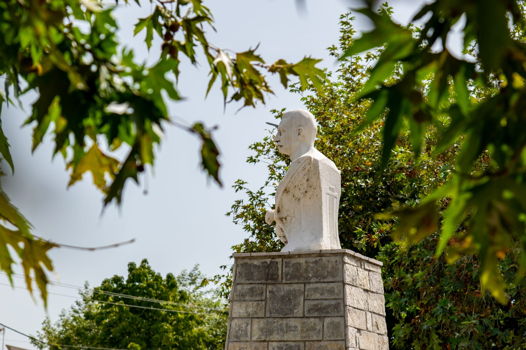
The square is located on the peripheral road of Arta, opposite the Intercity, Central bus station (KTEL). It is a narrow tree-planted area defined to the east by the peripheral road and to the west by the curved route of Krystalli Street. It is dedicated to the poet Costas Krystallis, whose bust adorns its center.
The marble bust was created by the sculptor Thomas Thomopoulos. Placed on a built-in base, it is strange at first sight, as the facial features do not reflect the poet’s young age (he died at the age of 26), which probably did not happen by chance since it is generally very inventive in symbolism. The head is slightly turned to the left so that the gaze is directed towards the mountain range of Tzoumerka, indicating the poet’s great love for the mountains. The bust is surrounded by the open wings of an attached, frontal eagle, an apparent reference to the homonymous poem by Krystallis and a clear symbolism of his desire to return free to the high mountains of his homeland. A relief plate is attached low, on the front side of the base with a composition consisting of objects that refer to the poet, a lyre, a crook, a flute, a chanter, and an open book with the inscription: “”the village and the sheep shed’s songs 1894.””
Students from Arta initiated the erection of the monument and raised the necessary money for the realization of the project. In this way, they honored the poet of the Greek mountains at the place of his death and burial.
Initially, the bust was placed near the Agios Theodoros church on the same side of the peripheral road, where it was unveiled in 1930. It was established in its current location later. It seems more appropriate since the house where he left his last breath is behind the square.
Costas Krystallis was born in 1868 in Syrrako, Ioannina. He published his first poem, “”The Shadows of Hell”” (1887) when he was still a student of the Zosimaia School in Ioannina. This was the reason for his persecution by the Turkish authorities, as he referred to the struggle for freedom and the heroes of 1821. To escape the arrest, he fled to Athens, where he began writing his works, poems, and short stories, which are idyllic and inspired by the mountainous nature of Epirus and pastoral life. They exude his nostalgia for the high mountains of his homeland. Struck by tuberculosis, he came to Arta, where his sister lived. A few months later, on April 22, 1894, he passed away at 26. The recognition of his work is stated by the announcement of his death, two days later, in the literary newspaper, “”Asty””:
“”The earth of Epirus, which he so passionately loved, covers from the day before yesterday a poet, a pearl that we will hardly find again in the plot of today’s life, for the loss of whom our emotion and tears are a small tribute of fondness and appreciation.””
He was buried in the Municipal Cemetery of Arta. On April 22, 2018, a memorial prayer was held at his grave, and wreaths were laid at his monument in Krystalli Square to mark the 150th anniversary of his birth.
Squares
Napoleonta Zerva Square
Pammegiston Taxiarchon Square
Koronisia
Koronisia or Korakonisia or Kyronisia is an island complex in the Amvrakikos Gulf, at a distance of 25 km from the city of Arta.
The environment: Small islands in a circular arrangement joined together by narrow strips of land, forming inland lakes and giving the image of a Polynesian atoll. It is believed that a reef once united the islands, a remnant of which is the narrow ground that connects them. Today, however, their morphology and the opalescence of water shades create a scenic environment rightly characterized as the Greek “”Polynesia””. At the same time, it is a magnificent wetland harmoniously integrated with the abundance of the Amvrakikos Gulf. The area is famous for the numerous species of fauna it hosts. Tsoukalio lagoon is home to the rare and endangered species of the Dalmatian pelican (Pelecanus crispus) (about 35 pairs). At the same time, the warm, shallow waters are an ideal breeding ground for many species of marine fauna. Soles, flathead grey mullets, sea basses, sea breams, eels, shrimps, cuttlefish, and rays are just some of the fish species that live in the waters of Koronisia.
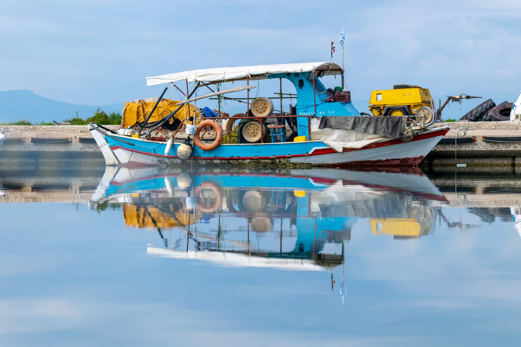
The village: In one of the islands, the so-called “”Pera Nisi””, the picturesque fishing village, also known as Koronisia, expands. The houses are developed in a circle on a small hill, overlooking the landlocked sea and the boats mooring in the port, providing the fish taverns with fresh fish and seafood. The village, according to the 2011 census, has 167 inhabitants. Previously, from 1997 to 2010, it was part of the Municipality of Amvrakikos based in Aneza. Today it belongs to the Regional Unit of Arta. The primary occupations are fishing and tourism. The fishing village has been developed as a tourist destination because of its natural beauty and fresh fish. It is easily accessible since a paved access road connects it with the land.
Monuments: Apart from the beautiful natural and residential environment and the culinary appeal, Koronisia has one of the most important, mid-Byzantine (late 10th century) monuments of the area of Arta. This church is dedicated to the Nativity of the Virgin. It is also known as the Virgin of Koronisia and is celebrated on the 8th of September. The monument was the monastery’s katholikon (central church building), having a solid economic and historical presence in the area during the Byzantine and the Ottoman periods. Saint Onoufrios, honored as patron saint on the 12th of June, lived as a hermit in the area.
Another historical monument is the well-preserved castle of Koulias, one of the forts of Amvrakikos Gulf, which functions nowadays as an event venue.
The Battle of Koronisia: Koronisia is directly connected with the constant military operations in eastern and western Sterea, during 1828-1829, since the governor, Ioannis Kapodistrias, attempted to include Sterea in the borders of Greece. One of these conflicts was the battle of Koronisia. The victorious outcome interrupted Kioutachis’s road to Roumeli. The leader of the Greeks was Athanasios Koutsonikas, who, in January 1929, disembarked on the island with 1,000 men and fortified it. Kioutachis, with 5,000 soldiers, barracked on the land across, and the conflict was fierce. The Turks fled and returned to Preveza. A little later, on the 10th of March, the Protocol of Independence was signed in London, which defined the first land border of Greece, the Pagasitic-Amvrakikos line.
Kilkis Square
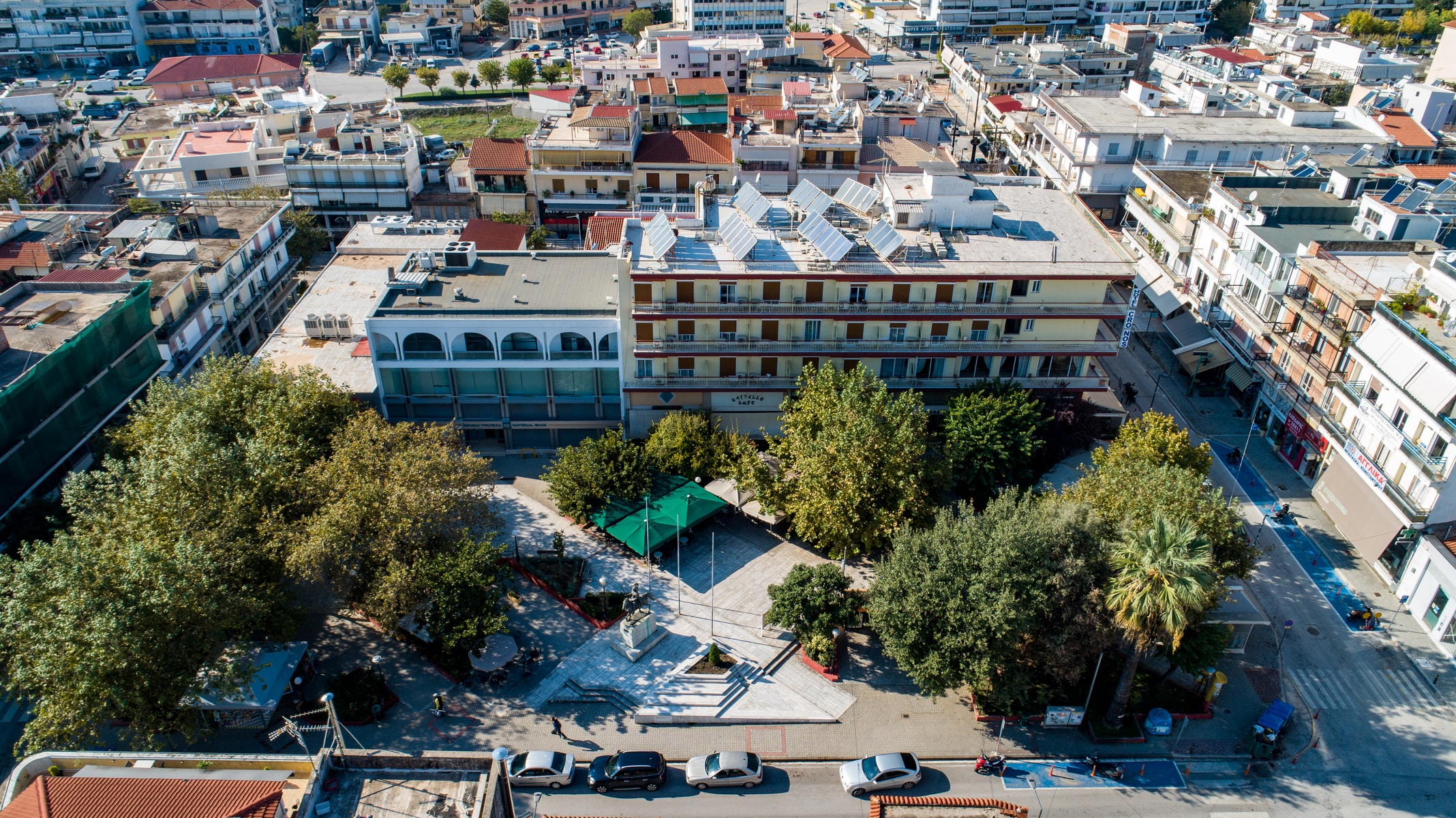
Kilkis Square is located one block north of Skoufa Square. It was formed at the beginning of the 20th century on the site of an Ottoman cemetery that occupied a large area, at the western end of the central market, the so-called Romiopazaro. Below was the Muhusti district, where the Turkish commander’s saray was located, and the annual bazaar took place every September.
According to Sotirios Sarlis, in an article on the news site “”The News of Mikrospilias 24″”, Kilkis Square was initially called “”Garoufalia Square”” because it was funded by Evangelos Garoufalias, twice mayor of Arta (1895-1899 and 1903-1907). He initiated many infrastructural projects, some of which had provoked reactions, such as the alignment of Romiopazaro, today Skoufa Street, at the end of which the square was developed.
After 1913, the square received its current name in honor of the dead in the battle of Kilkis (June 12-21, 1913). It is reported that an army corps had gathered in the square to be sent as reinforcements to the battle between Kilkis and Lahana, between Greek and Bulgarian forces, during the Second Balkan War. The battle ended with a Greek victory and the liberation of Kilkis. It was, however, one of the deadliest battles in the recent history of Greece, and, thus, from the army that left the Square of Arta, very few came back. The place name “”Kilkis”” reminds us of the unknown soldiers themselves and the place where all these people died.
The square was expanded and electrified by Michael Patsalias, who served as mayor from 1914 to 1925.
Next to Kilkis Square, a homonymous entertainment center used to change owners and style due to the high maintenance cost until it turned into a cinema and changed its name to “”Orpheus.”” The claim that the center was named “”Kilkis”” before the square did is not valid.
The long-distance central bus station used to be located in the square.
Sotiris Sarlis, in his article “”Arta, the History of Kilkis Square”” on the aforementioned news website, gives a nostalgic, detailed description of the square of the last century:
“”We remember Kilkis square, quiet, secluded, low-key, less cosmopolitan, without lights, with the taxi rank, the central bus station, the light sign of Papastratos cigarettes, the grill tavern of Harbis Sfikas (in its old place next to the agency), the warehouses of Devekos and below the inn of Georgopoulos. Later, when the independence street opened to Maximou Graikou, the tavern was moved next door, next to the Dimitriadis’ shop with electrical appliances, the entrance of the REX cinema, and the traditional bougatsa (cream pie) shop “”idanikon”” in the corner.
The HELLAS hotel was on the other side, in Skoufa. A total of four confectioneries of Skandalis cousins set tables and served customers in the square. “”Between the tables overlooking the street, there was a triptych board where the city’s cinemas advertised the movies being played, with photos and posters.””
And he goes on to give a piece of information that few know, that the square has a second name, it is also called “”Independence””.
Today, Kilkis Square blends harmonically with the modern city.
Rodavgi
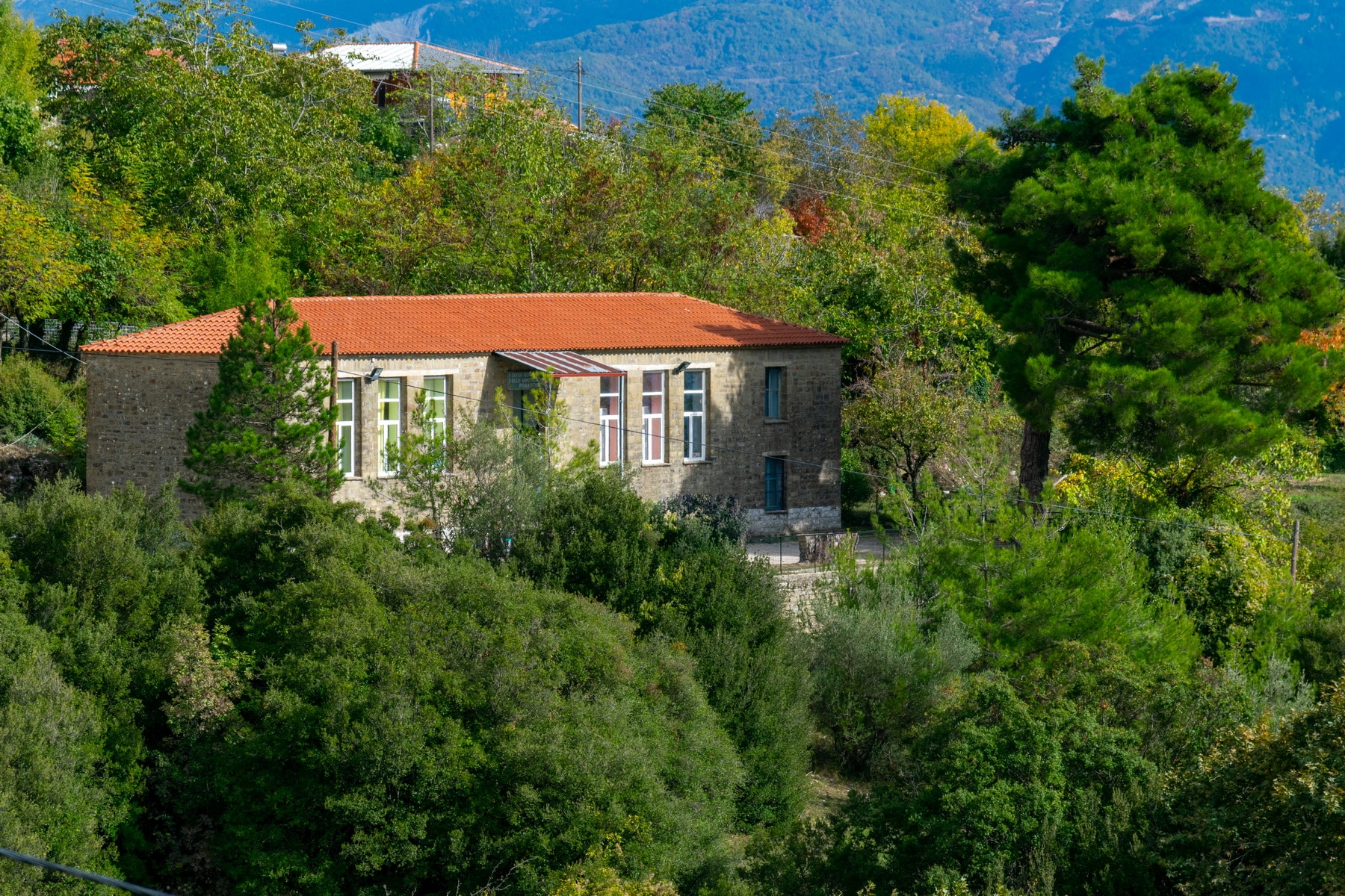
Rodavgi lies on the verdant, eastern slopes of Mount Xirovouni, 24 km north of Arta. It has an altitude of 703m. (at the square) and a panoramic view of Lake Pournari and the mountains of the eastern Tzoumerka, Agrafa, and Akarnanian mountains. The foundation of the current settlement probably originates in the years of Ottoman rule if we associate it with the construction of the central church of Agia Paraskevi that dates back to 1804. The inhabitants left the nearby, old settlement after its destruction from powerful landslides. The destroyed settlement is referred to as Agia Paraskevi, Chavos, and Kakolagado. According to tradition, Saint Paraskevi herself transferred her icon, indicating the place where they had to build her church. The new village was structured around the church. In 1962 it was named “”Rodavgi”” (rose dawn in Greek) since it overlooks the eastern horizon, which colors the settlement with the pink color of dawn. Rodavgi is one of the main villages of Arta, with approximately 250 permanent residents today. Its population reached 900 people in the past, and there were four primary schools with over 180 students. From 1969 to 1994, a three-level High School operated, and in 1970 a Housekeeping School was founded, being active for about a decade. Today, there is a kindergarten and a single teacher primary school, which gathers children from neighboring villages.
The inhabitants are mainly involved in farming and arboriculture. The main cultivated trees are the apple, the chestnut, and the zambela, from where the famous, traditional “Tsipouro of Rodavgi” is produced.
Rodavgi area has a rich flora because of its many springs. Rare endemic plants thrive, such as saffron, wild orchids, mushrooms, and aromatic plants such as thrombus, oregano, tea, sage, etc.
The exceptional climate of Rodavgi is considered responsible for the longevity of the inhabitants who maintain their close family ties and traditional customs of the fests.
A few words about the history of the area: The broader region of the Tzoumerks was, in antiquity, the residence of the Athamans, who were ruthless and aggressive people. The area was named Athamania and the mountains Athamanika after its inhabitants, and it was neighboring to the tribes of Amvrakiotes, Kasopaians, Tymfaians, Thessalians, and Dolopes. At that time, the story of Rodavgi begins, which is related to the ancient settlement “”Athenaion””. This toponym still survives due to a tavern’s name in the contemporary village. Athenaion was named after the homonymous fortress, part of the city’s defense system, where the “”Athenaea”” festival was held.
“”Nisista”” lies near the ancient Athenaion. The toponym connects the settlement with the raids and the domination of the Serbo-Slavs. The toponym is considered to relate to the word “”Island””. This belief is not supported by the location or the Slavic “”-ista”” ending. The metropolitan of Arta, Seraphim Xenopoulos, the Byzantine, mentions about Nisista that in his time (second half of the 19th century), the place was inhabited by 130 families who prayed in the churches of Agia Paraskevi, Agios Nikolaos, and many other chapels.
Ancient Athenian and medieval Nisista are both directly related to Rodavgi since their stories are perplexed. Besides, there are some indications of ancient habitation in the surrounding area: scattered fragments of tiles and a few unpainted clay fragments located mainly in the nearby settlement of Lapsaina. It has been claimed that Havo’s ancient walls and huge stones are preserved under the old settlement, but this can not be confirmed.
During Ottoman rule, Rodavgi was a Kefalochori (main village) and was ruled by the Mukhtar and two Aghas. The settlement was not liberated in 1881, at the same time as Arta. Arachthos River stood as the natural border between the liberated areas and those that continued to be under Turkish rule. Thus, Rodavgi had to wait another 30 years more or less to be liberated with Ioannina in 1913. During this period, many residents of Rodavgi, who could not tolerate the Turkish rule, left the village and settled in “”Elliniko”” at the other riverside. There, they created Pera Nisista, or Nisista of the old Greece, according to the medieval settlement of their area. Today this is the village Kentriko.
The many toponyms associated with Rodavgi create a veil of myth, folklore, and mystery around the village. For example, the toponym “”Chavos me ta Vaenakia kai to Kakolagado”” refers to the buried settlement. The toponym “”Dyo Pedakia”” is about two children who turned to marble in the middle of the mountain slope. “”Nero tis sykias”” lies under Mpistura. The toponym “”Derveni”” refers to the Great Blessing of Waters on Theophany. The most popular folklore tradition is the one that narrates the events of the foundation of the church with the guidance of Agia Paraskevi.
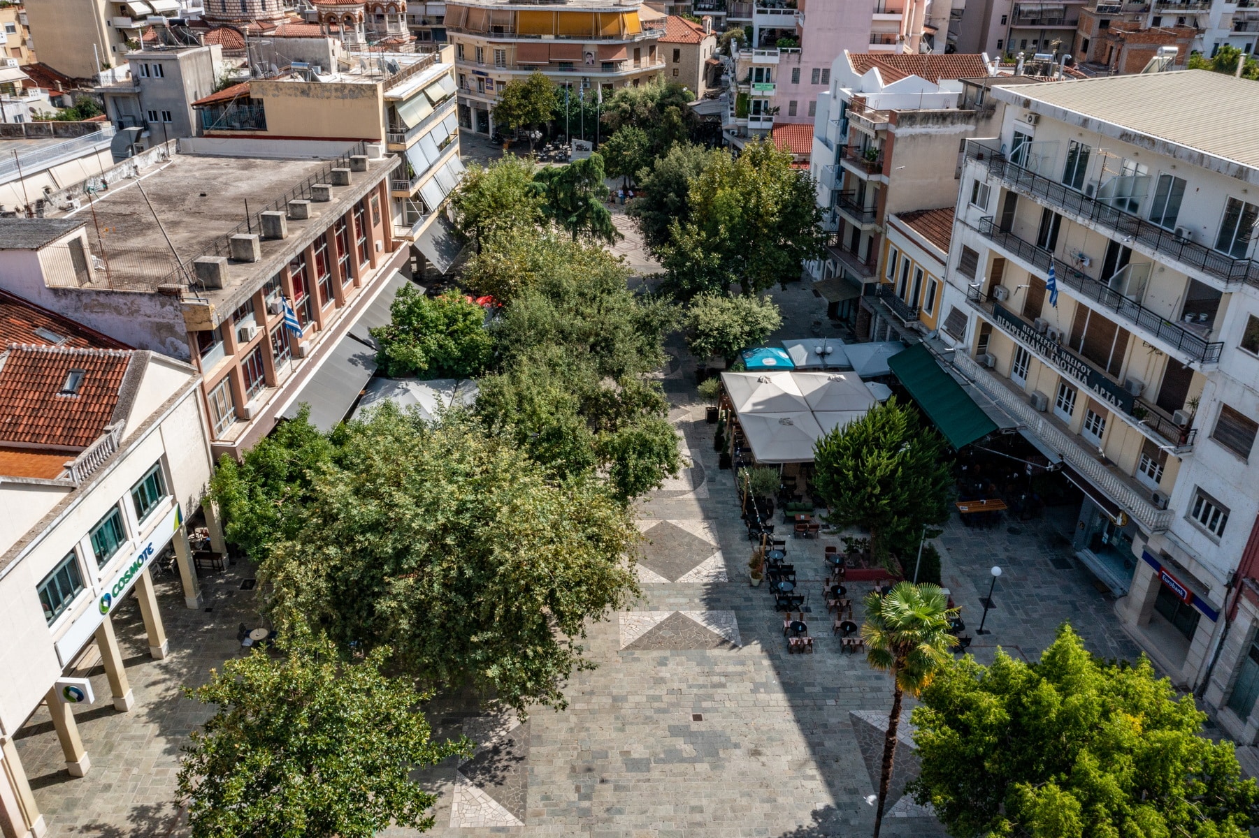
Skoufa Square
Skoufas Square is located in the center of Arta, southeast of Kilkis square and opposite the imposing church of Panagia Parigoritissa, the work of Nikiforos A, the Despot of Epirus. It occupies a building block defined by Skoufa, Orlandos, and Georgios Pachis streets.
Like the homonymous street and the famous Music and literature Association, “”O Skoufas,”” the square is named after Nikolaos Skoufas, one of the three founders of the Filiki Eteria (or Society of Friends), along with Emmanuel Xanthos and Athanasios Tsakalov. Born in Kompoti in Arta in 1779, he received the name “”Skoufas”” (skoufos means hat in Greek) as a nickname from the people of Arta themselves, due to his involvement in the manufacture of hats, during his first business steps in Arta.
Skoufa Square was designed by the great, Zakynthian architect Dionysis Zivas (1928-2018) and was built by Andrea Siamantas, a contractor. Garyfallia building, which today is a heritage of the “”Skoufas”” Association, lies to its northeast, while the tables of the coffee house “”en Arti”” fill its eastern side.
Having crisp lines, smooth surfaces, and limestone interrupted by green flower beds and terraces dominating, the space is organized on three levels that communicate with stairs.
In collaboration with the Technical Service and the Department of Electricity, the department of Green of the Municipality of Arta carried out, in 2012 landscaping and upgrading works on the lower part of Skoufa Square. As part of the works, they restored the original plan of the square, which various interventions had altered. In addition, they proceeded with the electric lighting, the construction of kennels, the installation of the underground irrigation system, and the planting of ornamental plants.
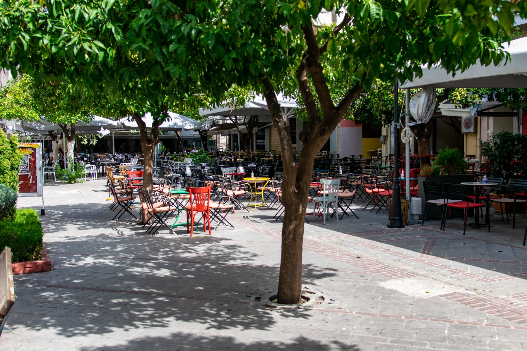
Its location and size make it one of the city’s most recognizable and busy squares. Built into the city’s center, with its shops, kiosks, bougatsa (cream pie) shop, and cafes, it has always had the character of a working-class square with an almost absent middle class. The area was a hangout place of the popular poet of Arta, Apostolis Karapanos (1899-1955).
Today, various events are organized in the square, such as youth festivals, modern and traditional music stages, Christmas fairy tales, motorcycle exhibitions, etc.
June 24th Square (Monopoleiou)
In the center of the city of Arta lies the Monopolio Square, and as its name suggests, it was a commercial market. During the Ottoman period and from the 17th century onwards, it was one of the two city squares, along with the Clock or the Hour square, where the weekly market (farmer’s market) was held. Its name is preserved to this day, an indisputable witness to its history. The whole district that extended from the square to the church of St. George and was adjacent to the Jewish quarter was also called Monopolio (or Monoplio).
The commercial transactions: The main commercial markets of Arta during the years of Ottoman rule were three and were named after the three main communities of the city. The first was the Romiopazaro, which occupied today’s Skoufa Street as far as Monopolio Square and was the main daily market with about 400 shops. The second was the Turkopazaro, which stretched from the Clock Square to the current public market, and the third was the Hebrew market, which developed from Monopolio Square to the castle. The commercial activity was completed by the annual market (trade fair) held for 8 to 10 days in September in the Mouhousti district and the weekly market in Monopolio Square.
Initially, the weekly market took place every Sunday. The event provoked reactions in the city’s Christian population, and in 1777 riots broke out between Christians and Jews. The former claimed that only the Jews of the city were interested in holding the market on Sunday, as this ensured uninterrupted trade every day of the week. Consequently, they demanded from the Ottoman authorities to change the day at the urging of Saint Cosmas of Etolos. Their request was successful, and the market was transferred to Thursday.
The market in Monopolio Square was used as a farmer’s market, which traded mainly food items. The producers of the surrounding villages arrived with their goods, in small quantities, either to sell them or to exchange them with other products, something that was not easy to do in the countryside. Farmers and stockbreeders hawked their merchandise, wine, fruits, vegetables, cheese, wool, eggs, and honey. These items were rarely traded in the daily local markets, so there was no competition. However, the square was a place of meetings and transactions all days of the week. Ioannis Makrygiannis mentions, in his Memoirs, Book A ‘, that during his stay in Arta, he saw lords, village leaders, and merchants gather in Monopolio Square and sit there until late at night. He even met them and carried out various commercial transactions.
Historical: The Square’s location in the city’s center made it the epicenter of various happenings and connected it with important historical events.
In Monopolio Square, the carnival custom of the “”bandides”” took place, during which the inhabitants danced wearing masks. With clear Venetian influences, the custom is said to date back to the time of the Despotate, when Charles I Tokkos (1411-1429) ruled. According to tradition, it started from a carnival party organized by the despot in his palace. Then he introduced the doctor’s mask, a figure known from the Venetian Commedia del Arte. He is the “”dotore di morto”” who roamed the streets of Venice on Halloween, referring to the two plague epidemics in which doctors walked around wearing masks to keep them from getting sick. The figure became very popular and reached the streets of Byzantine Arta, where the inhabitants had fun at the annual carnival party impersonating the Venetian doctors. Even after Arta’s conquest by the Ottomans (1449), the custom, gradually limited to the square, was maintained after the inhabitants’ request to the sultan.
Years later, during the Crimean War (1853-1856), the custom of “”Papoulias””, a mocking figure of the carefree roisterer, was added to the custom of “”bandides””. The following couplet refers to the custom: “”You have lost your “”malako””, my Papoulias, You have lost the “”mendziko””, the “”bandides”” took it, my Papoulias, they are taking it to Monoplio””. It is essentially a pun that satirized the events of the Russo-Turkish war. The words “”malako”” and “”mendziko”” referred to women’s clothing. At the same time, they referred to the Russian fortress, Malakov, and its defender, Mendzikov. According to the custom, “”Papoulias”” met the wife of Russian deputy consul of Arta and took a “”malako”” and a “”mendziko”” from her. Holding her clothes in his hand, he walked with his company along the Romiopazaro to the Monopoly Square, singing and teasing people. The “”bandides”” came to mingle with the cheerful company from the opposite direction. When they met “”Papoulias””, they dressed him in these controversial clothes and sang the couplet as they all walked together towards Monopolio square to continue the revelry.
Monopolio Square is not only associated with festive events. During the Turkish occupation, it was a market and a place of executions. The headless skeletons revealed in an excavation next to the square’s Panagia Kassopitra church provide strong evidence. As was the case with the bridge’s plane tree, the square was crowded. This was why these two locations were chosen as venues for executions. With the dreadful view of the victims (they placed their heads on stakes), the authorities considered that they were succeeding in setting an example for the others. The ruthless executions that took place in Monopolio during the 1821 revolution forced the inhabitants to leave the city out of fear and disgust. According to Seraphim Xenopoulos, Metropolitan of Arta (19th century), there was a cemetery next to the square where fighters of the battle of Peta were buried, making the Monopolio the most probable place for their execution.
The square retains its old name in the local community, despite its renaming by the municipal council to Eleftherias (Freedom) Square to honor the Greek army’s reception during the liberation of Arta, on the 24th June 1881. For the same reason, the second Turkish square of the Clock was renamed to King George A’ square, a name that in this case prevailed.
Next to the square, the first town hall of the free city operated with Ioannis Antonopoulos as mayor.
Ethnikis Antistasis Square
Ethnikis Antistasis (National Resistance) Square is the central square – park of Arta, on Skoufa Street, near Monopolio Square. It is better known as Agios Dimitrios Square since the city’s metropolitan church, which lies there, is dedicated to St. Dimitrios. It was associated with the National Resistance because of the homonymous monument that was erected just outside the church in 2005. It is paved and spacious with trees and surrounded by shops, agencies, and cafes.
The monument to the dead soldiers of the National Resistance (1941 – 1945) consists of two marble and rectangular slabs placed side by side, one on top of the other. A relief-like brass composition of figures has been adapted on the surface of the upper slab. The composition depicts a female winged figure with Victory, Freedom, and Peace characteristics, walking forward holding a dove. Behind her, two warriors follow, carrying their weapons. A fighter lying on the ground and a female figure leaning on him complete the composition.
The lower slab bears an inscription in honor of the dead during the national resistance, accompanied by lyrics of Kostis Palamas (Greek poet):
HONOR AND GLORY
TO THE FIGHTERS OF THE NATIONAL RESISTANCE
FOR THEIR LIBERATION FIGHT
AGAINST FOREIGN OCCUPATION
1941 – 1945
“”The greatness of nations is not measured in acres.
It’s measured with the fire in their hearts and their blood.””
Kostis Palamas
The two side slabs are based on a low, rectangular marble base.
A metal plate attached to the back of the monument gives information about the time and reason for its construction:
STANDING REQUEST OF
NATIONAL RESISTANCE FIGHTERS
1941 – 44 M. of ARTA
MARCH 2005
PANOS OIKONOMIDIS
MAYOR OF ARTA
The sculptor, Dimitrios Tsirogiannis, created the monument. Born in 1974, he studied at the Department of Fine and Applied Arts and has held numerous solo and group exhibitions in various cities in Greece, including Arta, Ioannina, Hydra, Athens, Thessaloniki, and Aegina. Apart from Arta, his works have been placed in Lesvos and Zitsa in Ioannina.
The Ethnikis Antistasis square is the busiest square of Arta, a place of meetings and various events.