The mountainous area of Arta is dominated by the Tzoumerka Mountains. They are the southern part of the Pindos mountain rage, with a group of villages and settlements known as Tzoumerkochoria (“The villages of Tzoumerka”).
Tzoumerka is heaven on earth, where visitors can enjoy every kind of activity: trekking, off-road running, climbing, mountaineering, ski mountaineering, river trekking and much more. Agnanda, Athamanio, Vourgareli, Theodoriana, Kataraktis, Koukoulia, Ktistades, Kipseli, Melissourgi and Ramia are just some of the villages “hanging” from the slopes of Tzoumerka, offering visitors a taste of authentic Greece.
Besides extreme sports, Tzoumerka is a place with plenty of touristic attractions: bridges and monasteries with centuries of history, watermills and mansions that date back to a time when this area was blooming with life in its beautiful villages, while the natural landscape is enchanting, with rivers, waterfalls, canyons and caves.
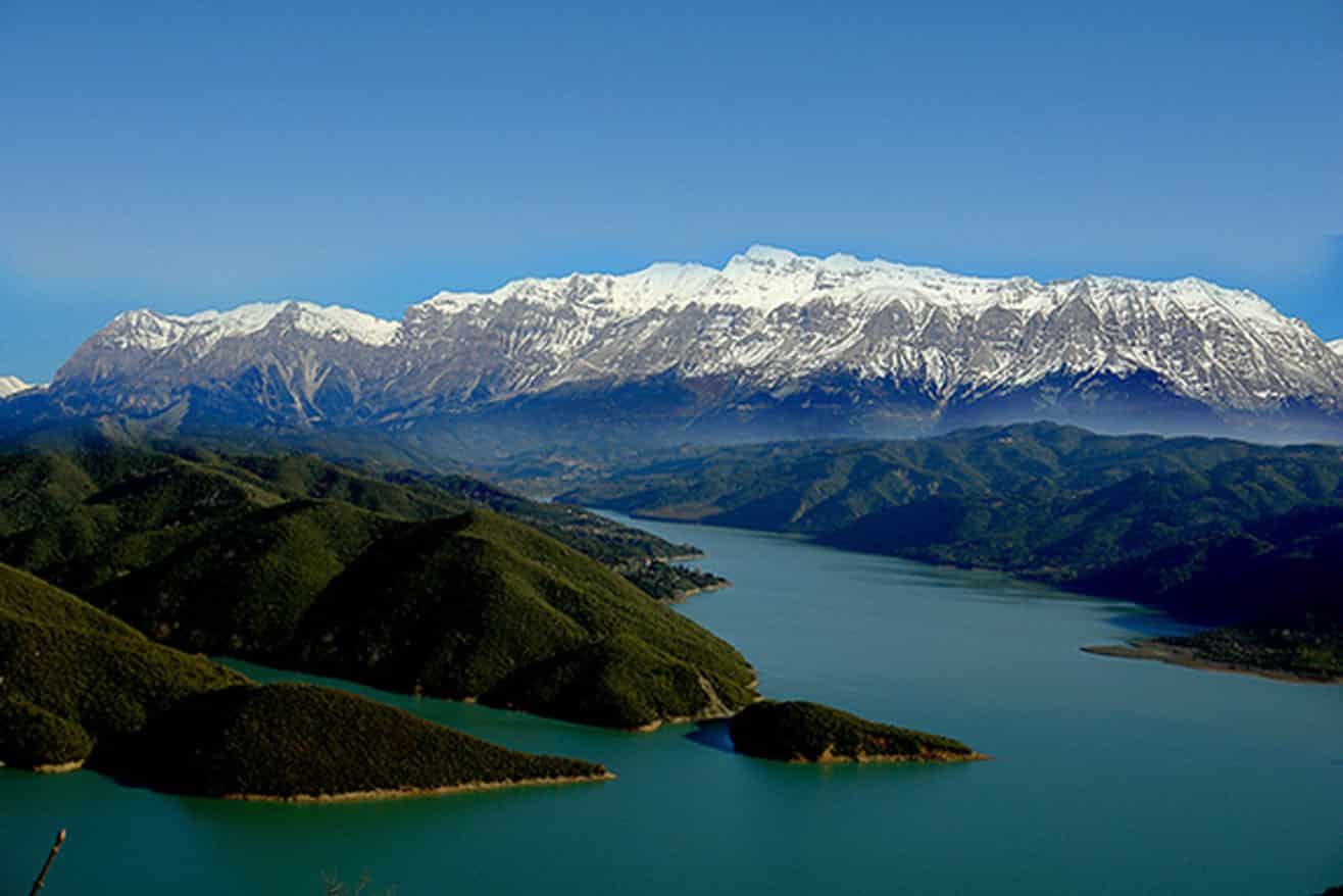
The artificial lake of Pournari was formed when the Pournari hydroelectric dam was constructed and stopped the flow of Arachthos river. The dam is the second biggest in Greece after the dam of Mornos, measuring 107 meters high, 580 meters long and 450 meters wide.
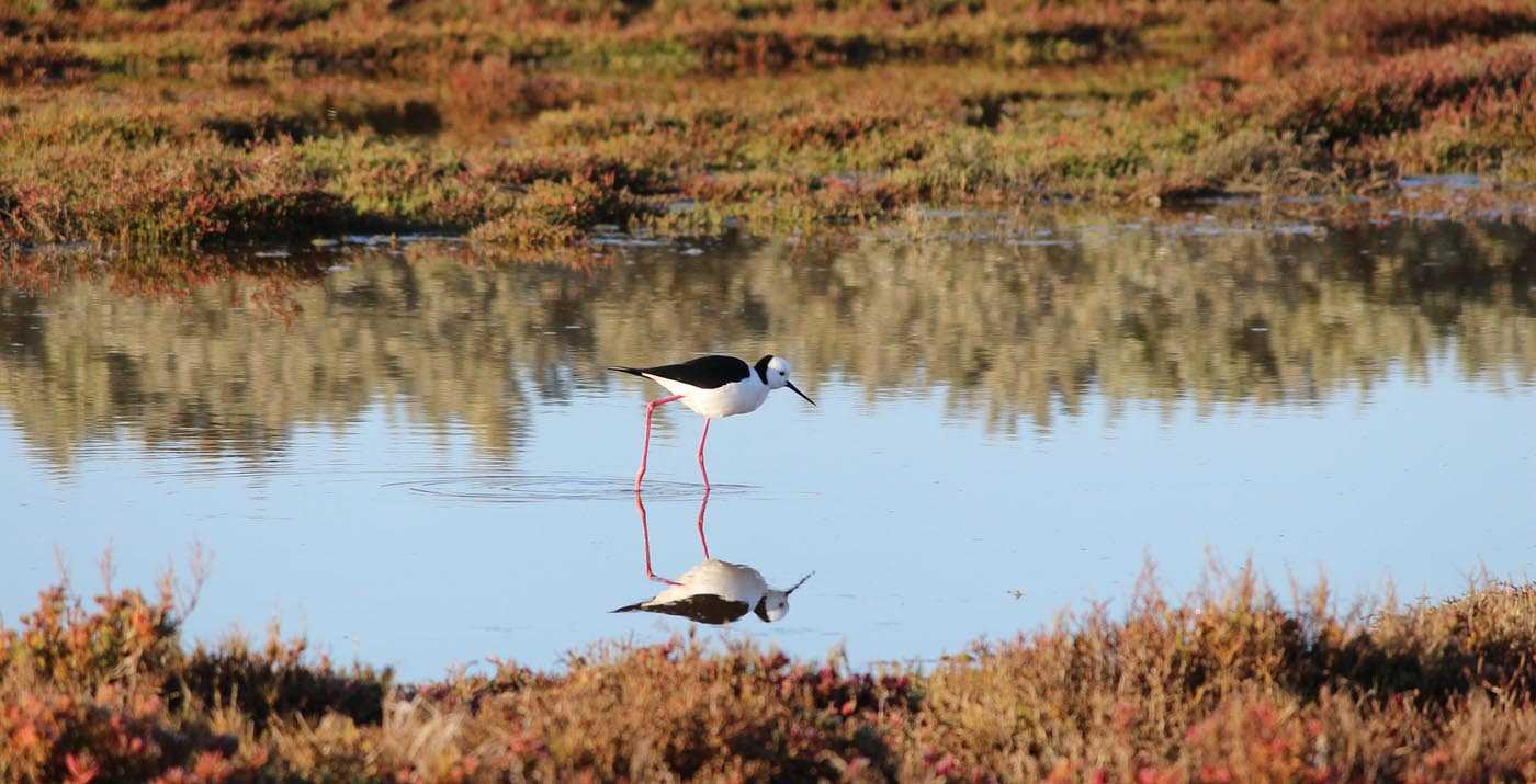
The lake hosts a great number of fish and birds, and the visitor has the opportunity to get familiar with it through various activities, such as trekking, fishing, expeditions and canoe-kayaking.
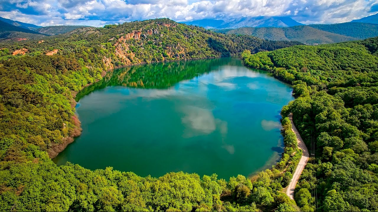
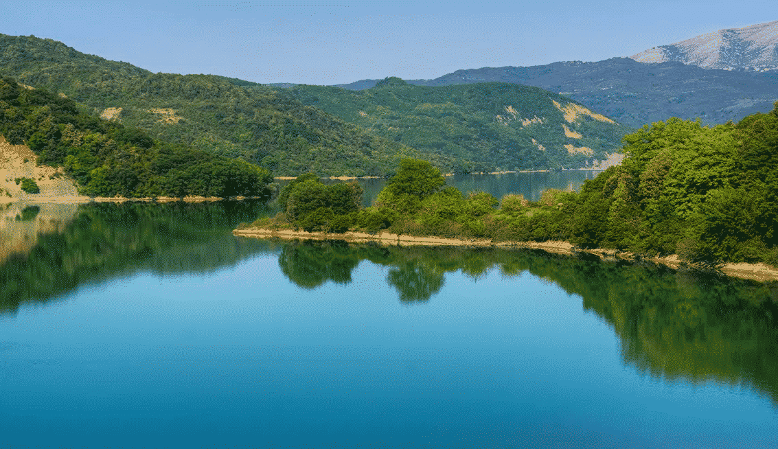
Ziros lake is a natural lake surrounded by a thick forest. It is not fed by neighbouring rivers or lakes but just underground by the Louros River, that flows in the east of the lake, while in the west of the lake the Thesprotian Mountains stand tall.
This area has a particularly dense vegetation, with tens of species of birds and animals, thus making the Ziros Lake a particularly interesting place to explore.
Arachthos river is the 8th largest river of Greece, with a length of 135 kilometers.
The etymology of his name is indicative of its nature, since Arachthos means “the one who lifts weight”, as the river is famous for the fury of its waters and its floods even nowadays.
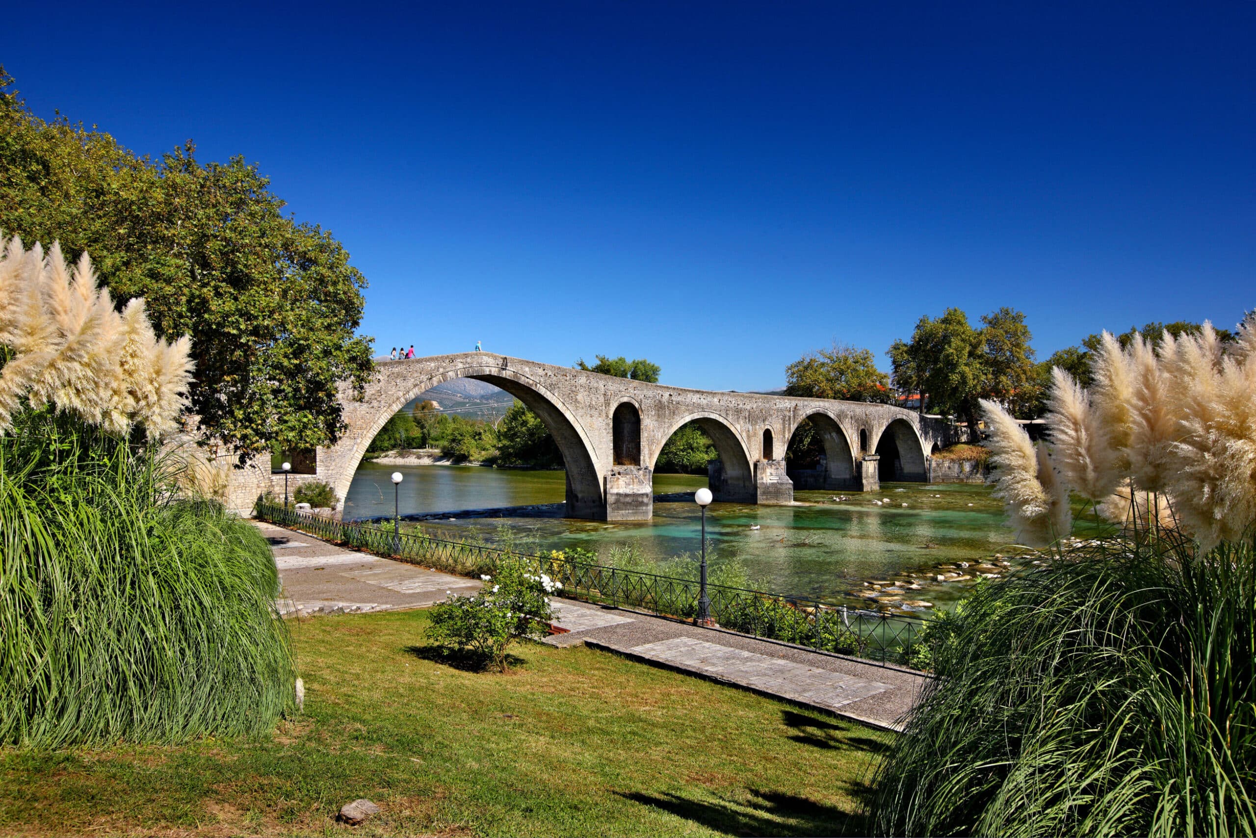
Moreover, Arachthos is famous because of the very popular folk song “The bridge of Arta”, where it is mentioned that the construction of the bridge was completed only after the sacrifιce of the Chief Mason’s wife, who was buried in the foundation of the bridge.
Arachthos is characterized by its rich flora and fauna. Besides, a lot of stone bridges (the most famous being the Bridge of Arta) were built in various points of its banks by the famous stone craftsmen of Epirus.
Louros river springs from Tomaros mountain in the prefecture of Ioannina, and empties into the Amvracian Gulf. Its importance for the surrounding area becomes obvious from the fact that in 31 BC the Roman emperor Octavianus Augustus ordered the construction of a huge aqueduct, measuring more than 50 kilometers long, in order to supply the newly-founded city of Nikopolis with water from Louros river.
Nowadays, the ruins of the aqueduct lie in the area of Agios Georgios of Philippiada, at a distance of 25 kilometers from Arta.
Acheloos is the second largest river of Greece, with a length of 220 kilometers, and the first with respects to the total amount of water. It even forms a natural border between Epirus and Thessaly regions.
The construction of hydroelectric dams alongside Acheloos was an effort to control its waters, since the river was famous for its floods ever since the time of the Labours of Hercules. Actually, Ancient Greeks worshipped Acheloos as a god, because of the fear they felt for it.
The most beautiful part of Acheloos is its valley, which besides its natural beauty, also has a cultural and religious heritage lost in the mists of time. Acheloos valley was the cradle of ancient civilisations because of its convenient geostrategic position, as well as the wealth that the river lavishly provided.
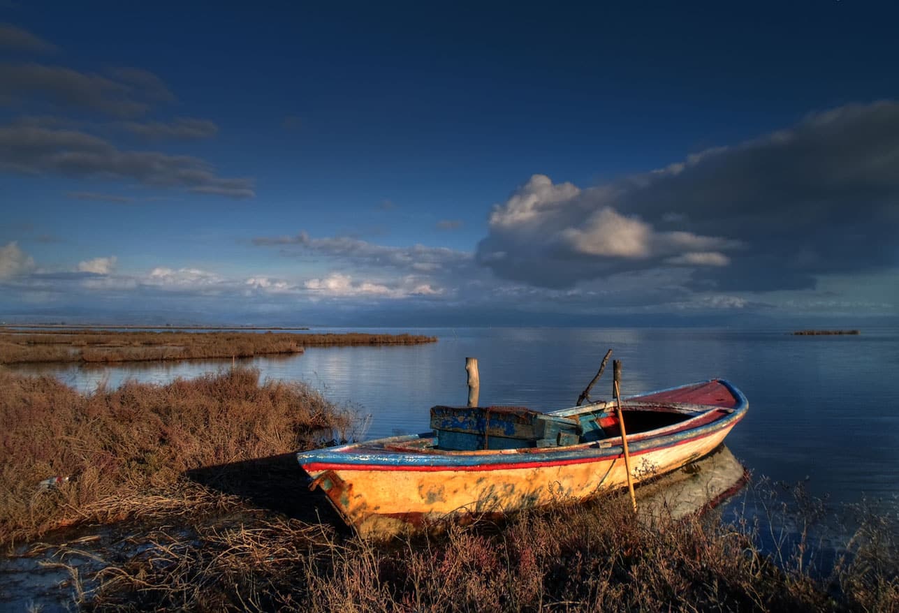
The Amvracian Gulf includes 24 lagoons, more than in any other place in Greece, with a total area of 70 square kilometers.
Most of them are divided from the sea by an elongated strip of land, usually made up of an uncountable number of shells. The three biggest lagoons of the Amvracian Gulf are Logarou, Tsoukalio and Rodia, with a size of 27, 17 and 14 square kilometers, respectively.
A basic feature of the Amvracian lagoons is their biodiversity, since due to the particularities of their formation, they function as natural farms of fish and crustaceans.
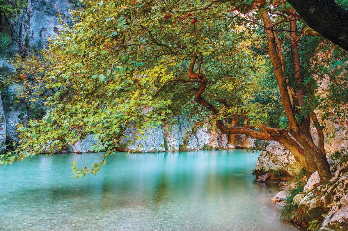
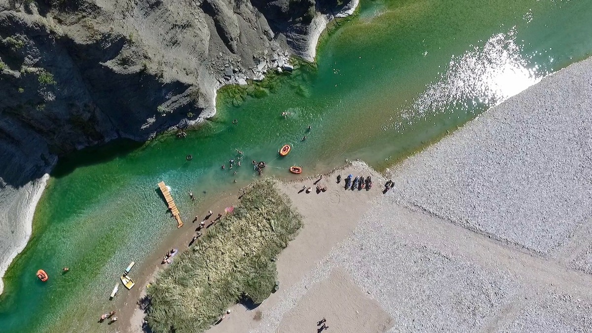
In ancient times Acheron was believed to be the river crossed by the god Hermes, the “conductor of souls”, who was delivering them to Charon, in order to be carried to the kingdom of Hades. It springs near the village of Glyki in the prefecture of Thesprotia, and empties into the Ionian Sea.
Its frozen waters form a landscape of incomparable beauty. Acheron hosts a lot of flora and fauna, which visitors can admire through plenty of activities such as horse riding, rafting, canoe-kayaking, nature watching and much more.
Explore more activities